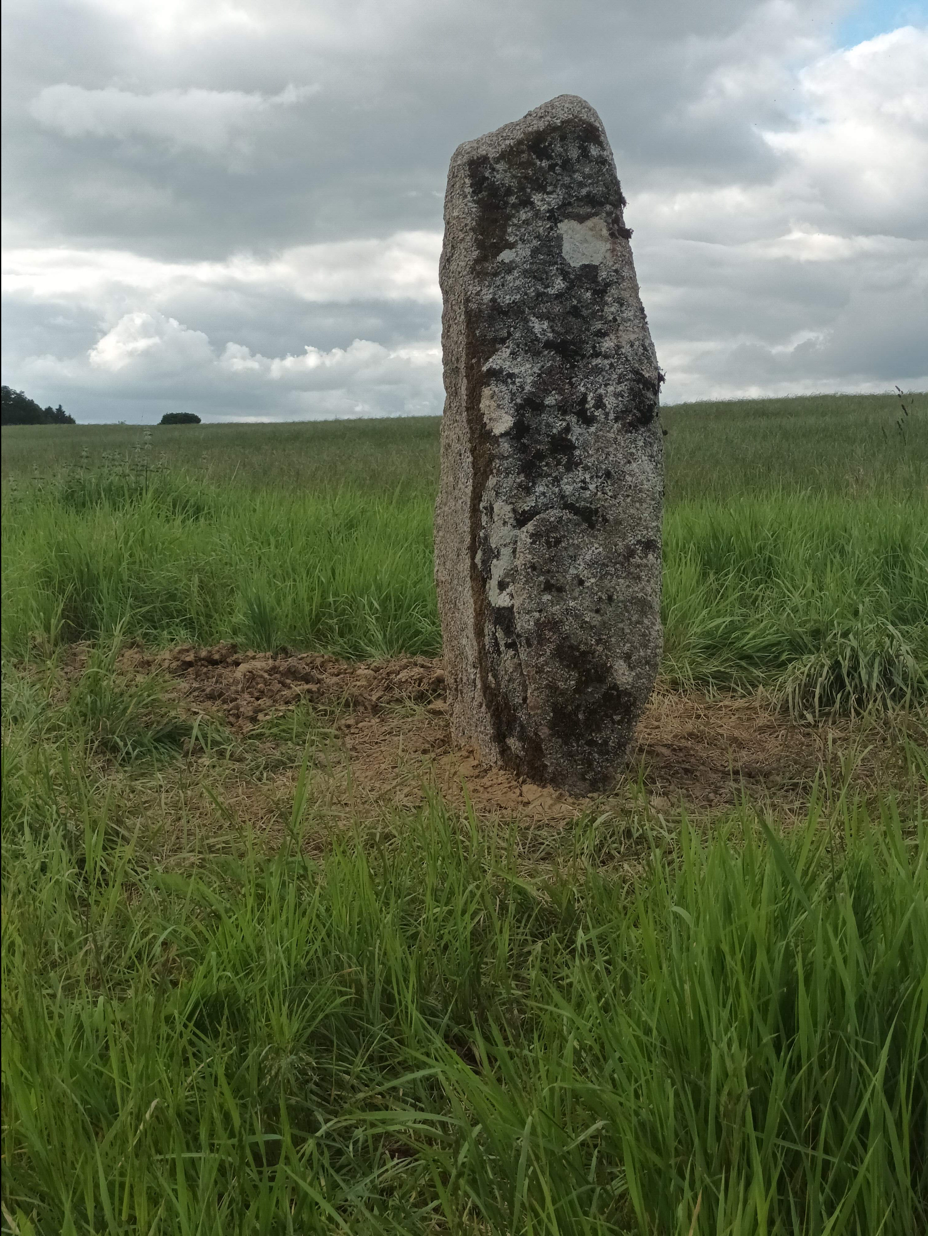


Heritage Summary
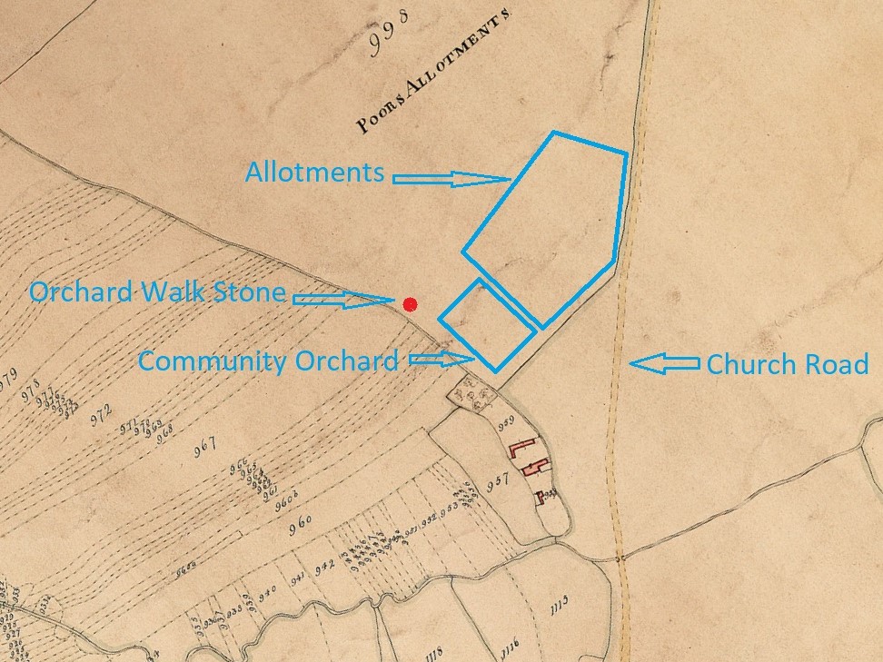
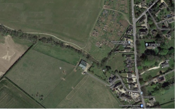
This stone stands adjacent to Littlestock Brook > , the woodland walk, the village allotments and the Community Orchard.
Land in this area, as elsewhere throughout the country, was privatised after the passing of a series of Enclosure laws, Milton being formally Enclosed in 1849.
Part of the land here was allocated as allotments for food and fuel replacing the previous access to the land as common right Historic developments > .
In recent years the area has seen the re-organisation of the allotments, now divided into two distinct management arrangements allotments > . The development of an important biodiversity project and flood management scheme; Flood management and biodiversity > , and the creation of the adjacent community orchard by a group of volunteers. Community orchard >
Littlestock Brook
Littlestock Brook is one of two brooks that skirt the village and eventually feed into the River Evenlode. The brook passes under a bridge that carries Church Road and is joined just before the bridge by a tributary that passes a small group of old cottages known as The Heath.
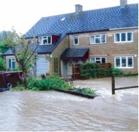
This area was the victim of flooding in 2007 when the waters of the brook and its tributary were too voluminous for the restricted passage under the bridge and flooded the area upstream, including the houses at The Heath.
The course of the brook was realigned by the Bruern Monks and its present course is not the original, this ran through the field to the south. The heavy rain caused the brook to spill over into its original course and flood the houses on the Heath from the rear, adding to the deluge.
Woodland Walk Stone: Flood Management and Biodiversity Project
In 2016, the natural flood management project in the Littlestock catchment began. The project has been successful in mitigating local flood risks, enhancing water quality, and creating new habitats.
The project involves testing catchment solutions that slow and store surface water flows.This reduces flood levels in the village. It is a collaborative effort between Wild Oxfordshire, the Environment Agency, and the Evenlode Catchment Partnership and the Parish Council.
Biodiversity Project: Trees and Woody Dams
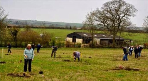
Trees play a crucial role in floodwater management. Riverside tree planting has encouraged water infiltration into the soil, preventing runoff directly into the brook. Additionally, the project includes Woodland Walk, native woodland strips along field edges. These create water storage areas.
The Woodland Walk was grant funded by Thames Water and was planted in 2018 by many village groups and individuals. Over 200 trees were planted.
Online ponds reconnect minor brook tributaries to their natural courses, capturing sediment and nutrients.
Woody dams installed by the parish council further regulate flow, preventing the brook bed being scoured away and promoting biodiversity. .
Meantime, field corner flood storage areas also support wildflower grasses and wetland habitats.

More: Littlestock Brook Project >
Community Orchard
The Community Orchard was established in 2014 by a group of community volunteers. Funding was by individuals sponsoring a tree and by some fundraising by Milton Women’s Institute.
The orchard committee chose to plant old Oxfordshire and Cotswold varieties. The orchard is intended as a community resource and villagers are invited to pick the fruits for themselves when they are ripe.
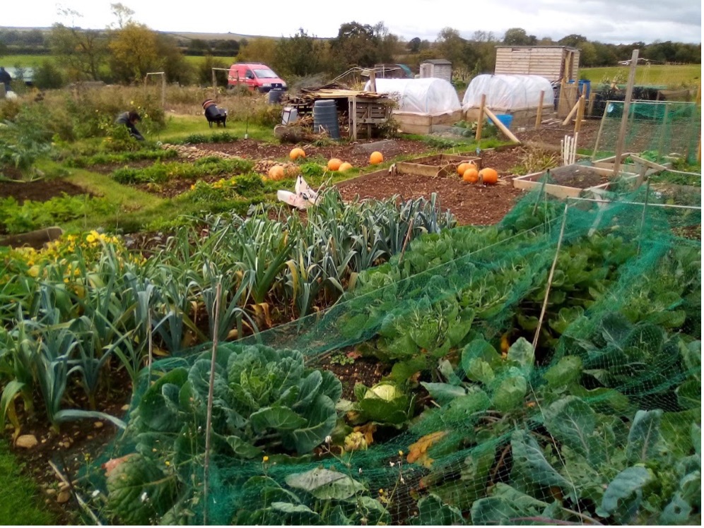
The Allotments
The area to the west of Littlestock Brook was once part of the open fields system of farming. Historic maps show the pattern of strips that were divided among local farmers before the rationalisation of Enclosure (see map detail from 1842 Tithe Map and see St Jude’s Meadow stone > )
The allotments were another village amenity established in the 19th Century, partly intended as compensation for villagers due to the loss of certain common rights with the effective privatisation of land that resulted from Enclosure.
Historic Developments
The allotments were made up of two types. The first of these comprised 20 acres of “fuel allotments” to replace the furze and thorn previously available to villagers as a right.
The second type comprised 18 acres of “poors allotments” ( see map >) a charitable endeavour where the rent from this area of land was allocated to poor-relief within the village. This included 5 acres of allotments rented from the local landowner (Earl Ducie in 1910). See Wychwoods History vol 17, 2002, p. 37 >
Evolution of the Poors Allotments
The allotments in the area nearest the stone have been established on land administered since 1970 by the Milton under Wychwood Welfare Trust.
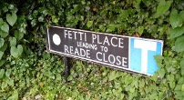
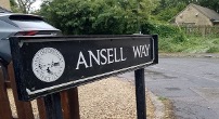
The trust was formed by the merger of 4 historic charities, which included the aforesaid Poors Allotment 1849 Milton Common Fields Enclosure Award (1849). The other 3 charities had been established from land gifted to the village by Ann Ansell (1891), from the Crown Inn Charity (1883) and by Sir George Fettiplace (1743).
These local names are remembered in local housing estates.
The land is used by local people as allotment plots to grow fruit, flowers and vegetables. Part of this area where the stone sits is also planted as a woodland walk.
The purpose of the Milton under Wychwood Welfare Trust is to relieve the need, hardship or distress of any resident living in Milton under Wychwood.
Each year the Trustees allocate funds to residents identified as being in
need either individually or to local organisations.
Evolution of the Fuel Allotments
The allotments on the farther side of the path which divides the allotment area are managed separately by the Milton Allotment and Recreation Charity.
These were originally part the Fuel Allotments covering much of the field from which both sets of allotments have been created. The field was set aside for any villager to grow produce including gorse. Gorse was used as kindling, and hence the derivation of the name.
With gorse no longer grown in recent memory, the name was changed and so the Milton Allotment and Recreation Charity was created. In the charity’s charter, the policy is to generate income from the allotment to support recreation in the village.
Quotes
The Deserted Village
By Oliver Goldsmith, an eighteenth century poet. The full poem is several hundred lines long and so is not repeated here, but is essentially a social commentary covering rural depopulation and the pursuit of excessive wealth.

I am standing by the stone in the sunshine and today had time to read the commentary on the QR code. Very interesting. Thank you